Tooting station
Introduction
The photograph on this page of Tooting station by Marathon as part of the Geograph project.
The Geograph project started in 2005 with the aim of publishing, organising and preserving representative images for every square kilometre of Great Britain, Ireland and the Isle of Man.

There are currently over 7.5m images from over 14,400 individuals and you can help contribute to the project by visiting https://www.geograph.org.uk
Tooting station
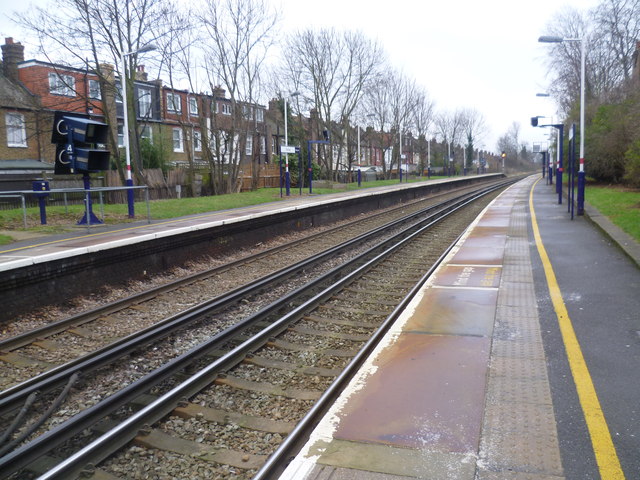
Image: © Marathon Taken: 21 Jan 2015
The railway line from Wimbledon to West Croydon opened in 1855. In 1868, the Tooting, Wimbledon & Sutton line was opened, and a branch from Tooting via Merton Abbey to the Wimbledon to West Croydon line at Merton Park was also opened. The last passenger train on the Tooting to Merton Park line ran on 2nd March 1929, and after that only steam freight trains and the occasional excursion used the line. The junction at the Tooting end was severed in 1934 so that the line was worked as a long siding from Merton Park. All traffic finally ceased in May 1975 and the tracks between Merton Park and Tooting were removed soon afterwards. The original Tooting station, opened with the rest of the line in 1868, was slightly further east than the present Tooting station. The present station opened in 1894 when it was called Tooting Junction as at that time trains ran to Wimbledon via either the Haydons Road branch or the Merton Park branch. Following the closure to passenger traffic of the line from Tooting to Merton Park in 1929 and its severance at the Tooting end in 1934, the station was renamed Tooting in 1938. Much of the old trackbed of the Tooting to Merton Park line has been built on, as can be seen on a Wimbledon-bound train soon after leaving Tooting station on the left, or is covered by new roads such as Merantun Way, now followed by the A24. However, other parts have been preserved to make linear parks such as at Myrna Close Valley - see http://www.geograph.org.uk/photo/2949136 This view from the down platform looks back towards Streatham.
Images are licensed for reuse under creativecommons.org/licenses/by-sa/2.0
Image Location
Latitude
51.419597
Longitude
-0.159706