Burghead
Introduction
The photograph on this page of Burghead by Anne Burgess as part of the Geograph project.
The Geograph project started in 2005 with the aim of publishing, organising and preserving representative images for every square kilometre of Great Britain, Ireland and the Isle of Man.

There are currently over 7.5m images from over 14,400 individuals and you can help contribute to the project by visiting https://www.geograph.org.uk
Burghead
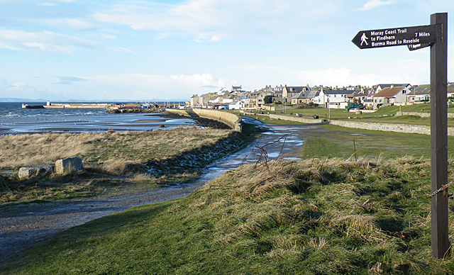
Image: © Anne Burgess Taken: 17 Jan 2015
Near the caravan site is the junction of various waymarked paths, including the popular walks to Findhorn via Roseisle. The sea wall extends right along the back of the beach to the harbour in the distance, with the village itself set higher and further back from the sea.
Images are licensed for reuse under creativecommons.org/licenses/by-sa/2.0
Image Location
Latitude
57.699519
Longitude
-3.489188