Fishergate, Looking West
Introduction
The photograph on this page of Fishergate, Looking West by David Dixon as part of the Geograph project.
The Geograph project started in 2005 with the aim of publishing, organising and preserving representative images for every square kilometre of Great Britain, Ireland and the Isle of Man.

There are currently over 7.5m images from over 14,400 individuals and you can help contribute to the project by visiting https://www.geograph.org.uk
Fishergate, Looking West
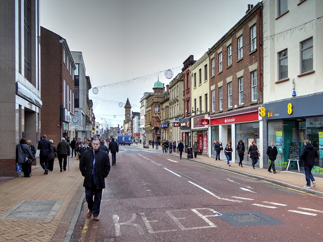
Image: © David Dixon Taken: 14 Jan 2015
Fishergate is the main shopping street in Preston with the usual stores M&S, BHS, WH Smiths etc. Since 2014, the area has been designated as 'Shared space'; an urban design approach which reduces the markings separating vehicles and pedestrians which involves removing kerbs and traffic signs to produce a more open space with widened pavements incorporating trees (http://www.preston.gov.uk/yourservices/transport-and-parking/roads-and-pavements/fishergate-central-gateway-project/ Fishergate Central Gateway project, Preston City Council). Neither cars nor pedestrians have right of way and it has been claimed, by “traffic experts”, that this makes the road safer as drivers have to stay on their guard (http://www.blogpreston.co.uk/2014/10/seven-things-you-said-on-fishergate-new-layout-completion/ Blog Preston).
Images are licensed for reuse under creativecommons.org/licenses/by-sa/2.0
Image Location
Latitude
53.758098
Longitude
-2.70055