Winter flow at Salmon Lane lock
Introduction
The photograph on this page of Winter flow at Salmon Lane lock by Stephen Craven as part of the Geograph project.
The Geograph project started in 2005 with the aim of publishing, organising and preserving representative images for every square kilometre of Great Britain, Ireland and the Isle of Man.

There are currently over 7.5m images from over 14,400 individuals and you can help contribute to the project by visiting https://www.geograph.org.uk
Winter flow at Salmon Lane lock
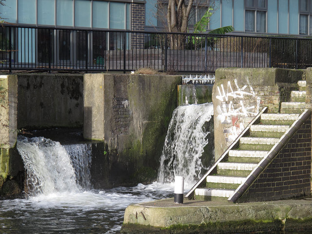
Image: © Stephen Craven Taken: 11 Jan 2015
Water was flowing over the weir of the disused western lock, and also down the bypass channel where it hits a concrete wall and executes a sudden 90 degree turn (generally not a good idea in design terms as even concrete will eventually be eroded by the water flow).
Images are licensed for reuse under creativecommons.org/licenses/by-sa/2.0
Image Location
Latitude
51.514698
Longitude
-0.035242