Gallowstree Roundabout
Introduction
The photograph on this page of Gallowstree Roundabout by Jonathan Hutchins as part of the Geograph project.
The Geograph project started in 2005 with the aim of publishing, organising and preserving representative images for every square kilometre of Great Britain, Ireland and the Isle of Man.

There are currently over 7.5m images from over 14,400 individuals and you can help contribute to the project by visiting https://www.geograph.org.uk
Gallowstree Roundabout
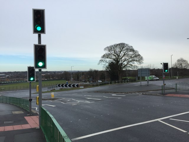
Image: © Jonathan Hutchins Taken: 14 Jan 2015
Nine years to the day after Image It is not possible to reproduce the vantage point of the earlier photograph without standing in the middle of a busy road! The roundabout was completely remodelled and rebuilt in 2009 at a cost of around £3m, being widened and creating additional traffic lanes. This caused considerable local controversy, since the opportunity for increased speed and density of traffic was viewed with alarm by pedestrians and cyclists, while the roadworks themselves caused severe traffic queues, backing up into Newcastle itself, and (allegedly) adversely affected some local businesses. Trees and bushes were destroyed leaving just the one tree in the centre of the roundabout. The purpose of the rebuilding was to improve access and traffic flow in the light of potentially extensive future development of Phase 3 of Keele University's Science and Business Park (currently still a delightful wildflower meadow!) Image
Images are licensed for reuse under creativecommons.org/licenses/by-sa/2.0
Image Location
Latitude
53.006724
Longitude
-2.252858