Jubilee Pond, Wanstead Flats
Introduction
The photograph on this page of Jubilee Pond, Wanstead Flats by Marathon as part of the Geograph project.
The Geograph project started in 2005 with the aim of publishing, organising and preserving representative images for every square kilometre of Great Britain, Ireland and the Isle of Man.

There are currently over 7.5m images from over 14,400 individuals and you can help contribute to the project by visiting https://www.geograph.org.uk
Jubilee Pond, Wanstead Flats
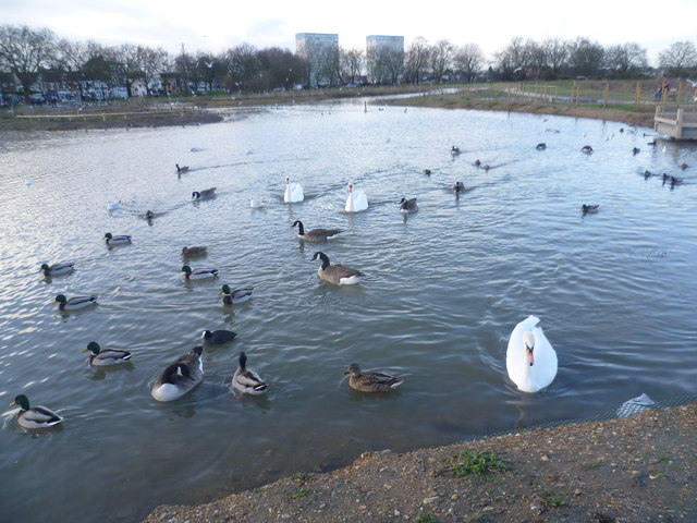
Image: © Marathon Taken: 14 Jan 2015
Wanstead Flats form the southernmost portion of Epping Forest. A perambulation of 1225 defined the southern boundary of Epping Forest as the main road from Bow Bridge via Stratford to Romford. The woodland extended south at least as far as Plashet at the time of the Domesday Book of 1086 (Plashet was a Norman-French name meaning a type of forest enclosure). Most of the woodland on what is now Wanstead Flats disappeared during the Middle Ages, and by the end of the 18th century the only unenclosed forest here was a few pieces on the southern fringe of Wanstead Flats. Further enclosure of the flats by Earl Cowley in 1871 caused protests, led by the City of London which was a commoner of the Forest after the purchase of Aldersbrook Farm to build the City of London Cemetery. These protests eventually led to the Epping Forest Act of 1878, which preserved the remaining Forest, including Wanstead Flats, from further encroachment or enclosure. This is Jubilee Pond, near Lake House Road and Dames Road, late on a chilly winter's afternoon.
Images are licensed for reuse under creativecommons.org/licenses/by-sa/2.0
Image Location
Latitude
51.557464
Longitude
0.019978