Garrison Bottom Lock
Introduction
The photograph on this page of Garrison Bottom Lock by Stephen McKay as part of the Geograph project.
The Geograph project started in 2005 with the aim of publishing, organising and preserving representative images for every square kilometre of Great Britain, Ireland and the Isle of Man.

There are currently over 7.5m images from over 14,400 individuals and you can help contribute to the project by visiting https://www.geograph.org.uk
Garrison Bottom Lock
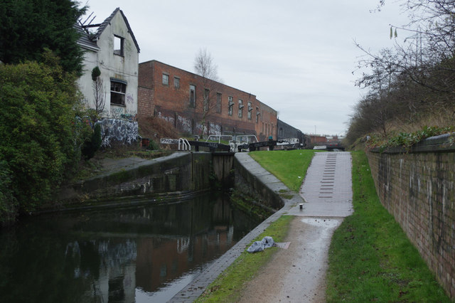
Image: © Stephen McKay Taken: 8 Jan 2015
The Grand Union Canal extends a few miles north of central Birmingham to Salford Junction under the M6. This final stretch is little used - most boaters preferring the parallel Birmingham & Fazeley Canal route through Aston Locks. It is not particularly pleasant - characterised by this burnt out lock cottage, and the water is full of rubbish. It's hard to believe that this is the same canal that includes such iconic locations as Stoke Bruerne and Braunston. This is Garrison Lock no 5, or no 63 (and the last) on the Grand Union.
Images are licensed for reuse under creativecommons.org/licenses/by-sa/2.0
Image Location
Latitude
52.489835
Longitude
-1.862844