Southwell Road East Vicinity, Rainworth, Notts.
Introduction
The photograph on this page of Southwell Road East Vicinity, Rainworth, Notts. by David Hallam-Jones as part of the Geograph project.
The Geograph project started in 2005 with the aim of publishing, organising and preserving representative images for every square kilometre of Great Britain, Ireland and the Isle of Man.

There are currently over 7.5m images from over 14,400 individuals and you can help contribute to the project by visiting https://www.geograph.org.uk
Southwell Road East Vicinity, Rainworth, Notts.
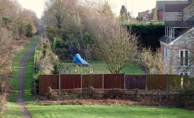
Image: © David Hallam-Jones Taken: 11 Jan 2015
Having left behind the point where The Mansfield Way (medium distance trail) route has just required walkers to cross the A617 (the dual carriage-way Rainworth by-pass), the track enters this dip, after which walkers are obliged to ascend this slope. This is at the rear of the first house on this stretch of the B2060 in the direction of Rainworth. The path is continuing to follow the route previously used by the Mansfield-Southwell Railway. A 2.5 mile long railway was built from Rolleston Junction on the Nottingham-Lincoln line to Southwell in 1847. In April 1871 the line was extended to Mansfield. This extension helped further development of the coalfield east of Mansfield, so much so that the increasing amount of coal-related traffic resulted in the whole line being doubled in the 1920s. The line closed to passengers in 1959.
Images are licensed for reuse under creativecommons.org/licenses/by-sa/2.0
Image Location
Latitude
53.125244
Longitude
-1.140391