Site of St.Andrew's church
Introduction
The photograph on this page of Site of St.Andrew's church by Richard Croft as part of the Geograph project.
The Geograph project started in 2005 with the aim of publishing, organising and preserving representative images for every square kilometre of Great Britain, Ireland and the Isle of Man.

There are currently over 7.5m images from over 14,400 individuals and you can help contribute to the project by visiting https://www.geograph.org.uk
Site of St.Andrew's church
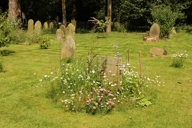
Image: © Richard Croft Taken: 18 Jun 2014
St.Andrew's church was built 1846-7 and consecrated in November 1847 with pews to seat 190 worshippers, though the growth of Woodhall Spa outstripped the church and a new church dedicated to Peter with capacity for 500 worshippers was built in 1893. St.Andrew's church survived unscathed until 1943 when it was structurally damaged by a parachute mine explosion and was eventually demolished in 1957. This stone in the churchyard marks the site of the altar and records its construction in 1847 and demolition in 1957.
Images are licensed for reuse under creativecommons.org/licenses/by-sa/2.0
Image Location
Latitude
53.151619
Longitude
-0.219148