View to Huntingtower Castle and hills to the north, from Letham, April 1979
Introduction
The photograph on this page of View to Huntingtower Castle and hills to the north, from Letham, April 1979 by Robin Stott as part of the Geograph project.
The Geograph project started in 2005 with the aim of publishing, organising and preserving representative images for every square kilometre of Great Britain, Ireland and the Isle of Man.

There are currently over 7.5m images from over 14,400 individuals and you can help contribute to the project by visiting https://www.geograph.org.uk
View to Huntingtower Castle and hills to the north, from Letham, April 1979
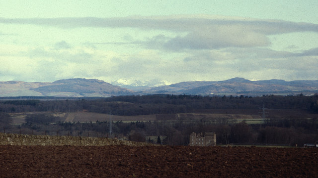
Image: © Robin Stott Taken: 15 Apr 1979
The view is thought to be from the track west past Letham House towards Newhouse Farm. Huntingtower Castle in Image guards the valley of the River Almond. To the north, hills press in on the River Tay. On the left is Birnam Hill in Image On the right skyline is Deuchary Hill, north of Dunkeld, in NO0348 with Newtyle Hill, east of Birnam, in front of it in Image The snow-covered slopes in the gap are thought to be the Perthshire hills north of Pitlochry. Scanned from a Kodak Ektachrome 200 slide ref 79·04·17
Images are licensed for reuse under creativecommons.org/licenses/by-sa/2.0
Image Location
Latitude
56.402552
Longitude
-3.487571