All Saints' church, Mixbury
Introduction
The photograph on this page of All Saints' church, Mixbury by Bikeboy as part of the Geograph project.
The Geograph project started in 2005 with the aim of publishing, organising and preserving representative images for every square kilometre of Great Britain, Ireland and the Isle of Man.

There are currently over 7.5m images from over 14,400 individuals and you can help contribute to the project by visiting https://www.geograph.org.uk
All Saints' church, Mixbury
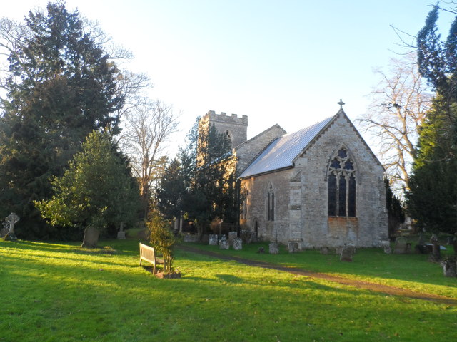
Image: © Bikeboy Taken: 2 Jan 2015
The chancel and nave are C12. The north aisle and tower were added in C13. The whole structure was rebuilt in the 1840's. The remains of C12 Beaumont Castle lie to the north of the church.
Images are licensed for reuse under creativecommons.org/licenses/by-sa/2.0
Image Location
Latitude
52.001017
Longitude
-1.114015