
Heysham Port
Introduction
The photograph on this page of Heysham Port by Ian Taylor as part of the Geograph project.
The Geograph project started in 2005 with the aim of publishing, organising and preserving representative images for every square kilometre of Great Britain, Ireland and the Isle of Man.

There are currently over 7.5m images from over 14,400 individuals and you can help contribute to the project by visiting https://www.geograph.org.uk
Heysham Port
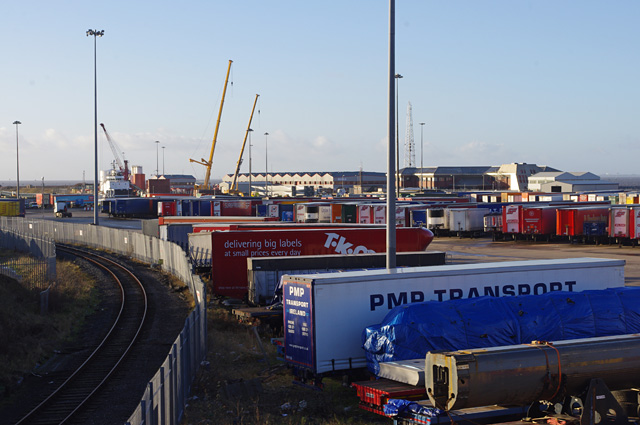
Image: © Ian Taylor Taken: 6 Jan 2015
The buildings at the back are the Morecambe Bay gas field service base on the north quay. In front of these, turbine parts for Heysham South wind farm have been unloaded from a cargo ship by the 2 yellow mobile cranes. The ship Image which has delivered them from Hamburg is almost entirely hidden by trailers. (The Natali (IMO 8203543) was detained here by the Maritime and Coastguard Agency for failing a Port State Control inspection, eventually leaving on 23 March.) The foreground, which used to be covered in railway sidings, is now used for trailer parking. (Most of the freight traffic is loaded on and off the ferries by dedicated tractors, to save lorry drivers making the crossing.) The railway line runs to Heysham Port station, and is used by one train a day, which connects with the daytime Isle of Man ferry.
Images are licensed for reuse under creativecommons.org/licenses/by-sa/2.0
Image Location

Latitude
54.035287
Longitude
-2.914688