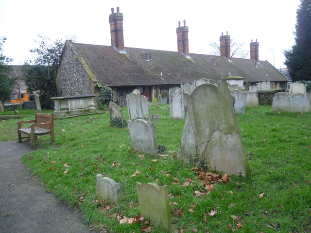
Leyton United Almshouses seen from Leyton Churchyard
Introduction
The photograph on this page of Leyton United Almshouses seen from Leyton Churchyard by Marathon as part of the Geograph project.
The Geograph project started in 2005 with the aim of publishing, organising and preserving representative images for every square kilometre of Great Britain, Ireland and the Isle of Man.
There are currently over 7.5m images from over 14,400 individuals and you can help contribute to the project by visiting https://www.geograph.org.uk

Image: © Marathon Taken: 7 Jan 2015
Almshouses have adjoined Leyton Parish Church since 1656 when John Smith's almshouses were opened. The present building, seen here from the churchyard, dates from later, having been opened on 9th February 1886. They were designed in a Tudor style and to quote The Almshouses of London by Clive Berridge: "... the use of flint and stone in their construction, the low single storey design and the position of the almshouses nestling amid the greenery of the churchyard in Church Road combine to give a vivid impression of what it must have been like to live in a humble and isolated rural almshouse." The almshouses are now called Leyton United Almshouses. Domesday Book records two priests in Leyton in 1086 so the current church almost certainly occupies the site of a much earlier building.The red brick tower of St Mary the Virgin, Leyton dates from 1658. It has an 18th century clock turret on top. Other parts date from the 17th and 19th centuries, although the church was much altered and enlarged in 1932. The churchyard is very much like a country churchyard dropped down into densely-packed east London. The northern half is maintained as a nature reserve although the whole is of great ecological and historical interest.

