Huddersfield Broad Canal, South of Wakefield Road
Introduction
The photograph on this page of Huddersfield Broad Canal, South of Wakefield Road by David Dixon as part of the Geograph project.
The Geograph project started in 2005 with the aim of publishing, organising and preserving representative images for every square kilometre of Great Britain, Ireland and the Isle of Man.

There are currently over 7.5m images from over 14,400 individuals and you can help contribute to the project by visiting https://www.geograph.org.uk
Huddersfield Broad Canal, South of Wakefield Road
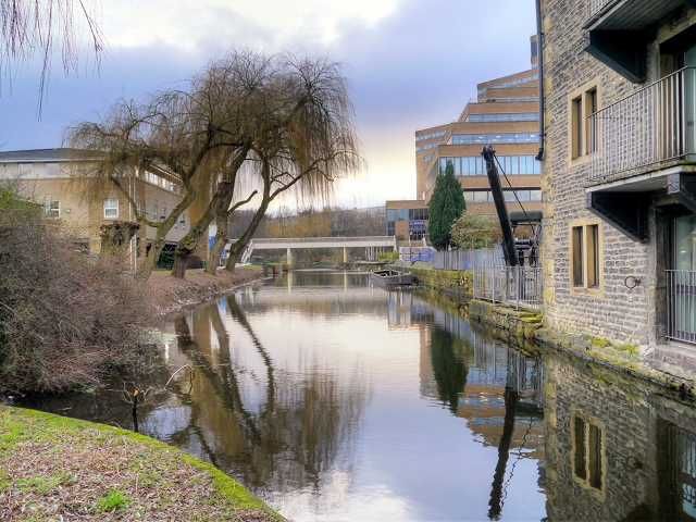
Image: © David Dixon Taken: 5 Jan 2015
The section of the Huddersfield Broad Canal between Wakefield Road Bridge and Lock 1 of the Narrow Canal was restored and landscaped as part of the re-development of the area for the University. However, following strengthening work to Wakefield Road which included the construction of a reinforced concrete tunnel under the original bridge in the 1970s, this short section has been inaccessible from the rest of the Broad Canal and is only navigable to vessels whose width is less than 7 feet (narrowboats). This view is looking south, from the towpath at Wakefield Road.The building to the right is the former warehouse detailed in Image Ahead is the Poly footbridge connecting parts of the University campus as shown in Image
Images are licensed for reuse under creativecommons.org/licenses/by-sa/2.0
Image Location
Latitude
53.64408
Longitude
-1.775637