St. Giles' Church, Ashtead
Introduction
The photograph on this page of St. Giles' Church, Ashtead by Thomas Grant as part of the Geograph project.
The Geograph project started in 2005 with the aim of publishing, organising and preserving representative images for every square kilometre of Great Britain, Ireland and the Isle of Man.

There are currently over 7.5m images from over 14,400 individuals and you can help contribute to the project by visiting https://www.geograph.org.uk
St. Giles' Church, Ashtead
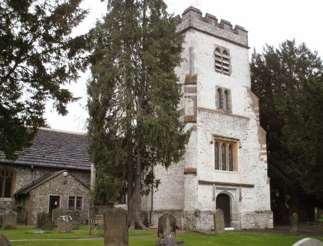
Image: © Thomas Grant Taken: 11 May 2007
C12th parish church of St. Giles. The church and graveyard are situated in the extensive earthworks of an earlier Roman property and Roman tiles are incorporated into the south wall of the nave. The tower is C15/C16th. The northern extension (to the left of the tower) is C19th.
Images are licensed for reuse under creativecommons.org/licenses/by-sa/2.0
Image Location
Latitude
51.308887
Longitude
-0.289537