St Mary's East Claydon
Introduction
The photograph on this page of St Mary's East Claydon by Bikeboy as part of the Geograph project.
The Geograph project started in 2005 with the aim of publishing, organising and preserving representative images for every square kilometre of Great Britain, Ireland and the Isle of Man.

There are currently over 7.5m images from over 14,400 individuals and you can help contribute to the project by visiting https://www.geograph.org.uk
St Mary's East Claydon
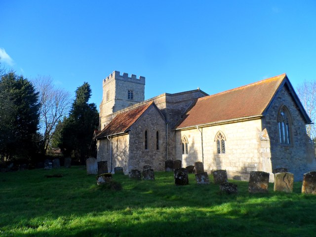
Image: © Bikeboy Taken: 2 Jan 2015
The chancel is C14 and the tower C15-C16. The church was badly damaged/demolished during the Civil War and rebuilt after the restoration of the monarchy. The church was extensively restored by George Gilbert Scott in 1871
Images are licensed for reuse under creativecommons.org/licenses/by-sa/2.0
Image Location
Latitude
51.923384
Longitude
-0.925483