Doddinghurst Common between Cow Farm Lane and the Ongar Road
Introduction
The photograph on this page of Doddinghurst Common between Cow Farm Lane and the Ongar Road by Hugh Gorton as part of the Geograph project.
The Geograph project started in 2005 with the aim of publishing, organising and preserving representative images for every square kilometre of Great Britain, Ireland and the Isle of Man.

There are currently over 7.5m images from over 14,400 individuals and you can help contribute to the project by visiting https://www.geograph.org.uk
Doddinghurst Common between Cow Farm Lane and the Ongar Road
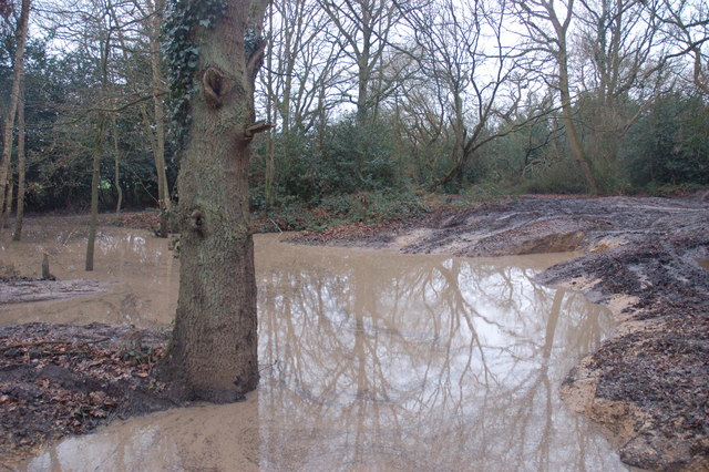
Image: © Hugh Gorton Taken: 6 Jan 2015
Between the lane and the footpath to the Ongar Road the wooded area has been extensively damaged by 4x4's. Very deep hollows and ruts have been made which have flooded. Most of the undergrowth has been destroyed and many of the trees damaged.
Images are licensed for reuse under creativecommons.org/licenses/by-sa/2.0
Image Location
Latitude
51.658869
Longitude
0.272597