Plaque marking the site of Northgate, Winchester
Introduction
The photograph on this page of Plaque marking the site of Northgate, Winchester by Jaggery as part of the Geograph project.
The Geograph project started in 2005 with the aim of publishing, organising and preserving representative images for every square kilometre of Great Britain, Ireland and the Isle of Man.

There are currently over 7.5m images from over 14,400 individuals and you can help contribute to the project by visiting https://www.geograph.org.uk
Plaque marking the site of Northgate, Winchester
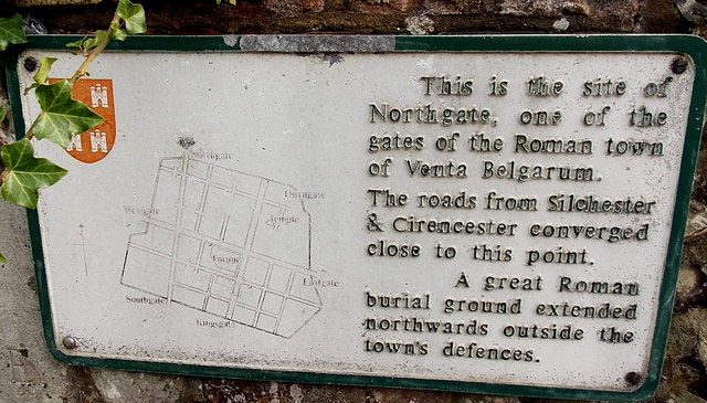
Image: © Jaggery Taken: 28 Sep 2014
The plaque is on the wall at the corner of Hyde Street and the B3330 North Walls. It marks the site of Northgate, one of the gates of the Roman town of Venta Belgarum. The roads from Silchester and Cirencester converged close to this point. A great Roman burial ground extended northwards outside the town's defences.
Images are licensed for reuse under creativecommons.org/licenses/by-sa/2.0
Image Location
Latitude
51.066071
Longitude
-1.315792