The former Romping Donkey at Hassall Green
Introduction
The photograph on this page of The former Romping Donkey at Hassall Green by Stephen Craven as part of the Geograph project.
The Geograph project started in 2005 with the aim of publishing, organising and preserving representative images for every square kilometre of Great Britain, Ireland and the Isle of Man.

There are currently over 7.5m images from over 14,400 individuals and you can help contribute to the project by visiting https://www.geograph.org.uk
The former Romping Donkey at Hassall Green
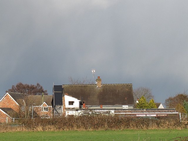
Image: © Stephen Craven Taken: 24 Dec 2014
At one time this was one of the best country pubs in the area. Another photo on this site shows it still open in 2010 Image Being a 17th century inn, it is also grade 2 listed (list entry number 1309973) and therefore could not easily be demolished. But in the last few years it has closed and become derelict.
Images are licensed for reuse under creativecommons.org/licenses/by-sa/2.0
Image Location
Latitude
53.122403
Longitude
-2.330492