Barn Field (2)
Introduction
The photograph on this page of Barn Field (2) by Simon Carey as part of the Geograph project.
The Geograph project started in 2005 with the aim of publishing, organising and preserving representative images for every square kilometre of Great Britain, Ireland and the Isle of Man.

There are currently over 7.5m images from over 14,400 individuals and you can help contribute to the project by visiting https://www.geograph.org.uk
Barn Field (2)
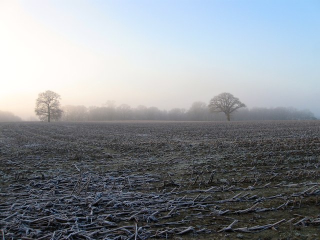
Image: © Simon Carey Taken: 30 Dec 2014
Another view of Image with out the view restricting maize crop in place when I last visited in autumn. The view thus shows how the field has been extended to include Image to the south, the two lone oaks being the remnant of the former field boundary. The tree tops of Kiln Wood is visible through the early morning mist.
Images are licensed for reuse under creativecommons.org/licenses/by-sa/2.0
Image Location
Latitude
50.986612
Longitude
-0.155509