Poslingford village sign
Introduction
The photograph on this page of Poslingford village sign by Adrian S Pye as part of the Geograph project.
The Geograph project started in 2005 with the aim of publishing, organising and preserving representative images for every square kilometre of Great Britain, Ireland and the Isle of Man.

There are currently over 7.5m images from over 14,400 individuals and you can help contribute to the project by visiting https://www.geograph.org.uk
Poslingford village sign
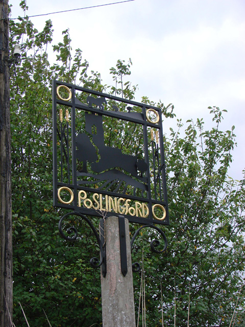
Image: © Adrian S Pye Taken: 15 Oct 2008
At the top border of the sign is a heavy horse in the pasture representing the importance of the horse before the tractor and mechanisation. On each side are straws of golden wheat symbolic of the arable farming. In the centre panel is the church of St Mary with the trees, just as they are in the churchyard. The tributary of the Chilton Stream is no longer a ford but is represented by the wavy line between the church and the ploughed field in the foreground. The gold ring in each corner, relates to the Poslingford ring, found by a resident in the village while gardening in 1955. It was found to be from the 9th century and is in the British Museum. https://www.geograph.org.uk/photo/6784990
Images are licensed for reuse under creativecommons.org/licenses/by-sa/2.0
Image Location
Latitude
52.104741
Longitude
0.58283