Marlesford village sign
Introduction
The photograph on this page of Marlesford village sign by Adrian S Pye as part of the Geograph project.
The Geograph project started in 2005 with the aim of publishing, organising and preserving representative images for every square kilometre of Great Britain, Ireland and the Isle of Man.

There are currently over 7.5m images from over 14,400 individuals and you can help contribute to the project by visiting https://www.geograph.org.uk
Marlesford village sign
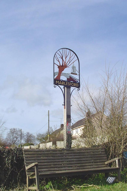
Image: © Adrian S Pye Taken: 28 Feb 2007
Marlesford village sign depicts the old post mill which once stood in Mill Lane. The bridge over the River Ore, (represented by the wavy blue line at the bottom) is representative of the old bridge on the A12 before it was replaced by the much stronger flat bridge. The ford, from which Marlesford takes its name is still not bridged, except by a footbridge. The tree which appears to be a pollarded willow is probably included because there were, at one time in the past, a number of them along the river bank. https://www.geograph.org.uk/photo/6779913
Images are licensed for reuse under creativecommons.org/licenses/by-sa/2.0
Image Location
Latitude
52.173243
Longitude
1.403017