View from Walder's Low
Introduction
The photograph on this page of View from Walder's Low by Dave Pickersgill as part of the Geograph project.
The Geograph project started in 2005 with the aim of publishing, organising and preserving representative images for every square kilometre of Great Britain, Ireland and the Isle of Man.

There are currently over 7.5m images from over 14,400 individuals and you can help contribute to the project by visiting https://www.geograph.org.uk
View from Walder's Low
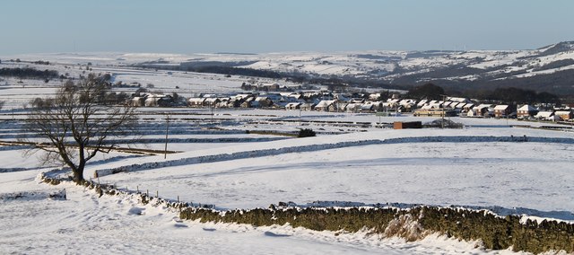
Image: © Dave Pickersgill Taken: 28 Dec 2014
The view from Walder's Low in a NW direction. In the foreground can be seen the ground of Stocksbridge RUFC. The mid-distance shows Whitwell estate and the hills towards Penistone are in the distance.
Images are licensed for reuse under creativecommons.org/licenses/by-sa/2.0
Image Location
Latitude
53.474368
Longitude
-1.599204