Dallinghoo village sign
Introduction
The photograph on this page of Dallinghoo village sign by Adrian S Pye as part of the Geograph project.
The Geograph project started in 2005 with the aim of publishing, organising and preserving representative images for every square kilometre of Great Britain, Ireland and the Isle of Man.

There are currently over 7.5m images from over 14,400 individuals and you can help contribute to the project by visiting https://www.geograph.org.uk
Dallinghoo village sign
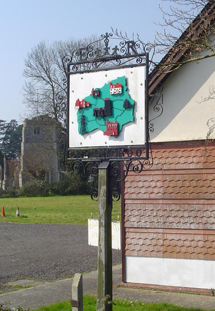
Image: © Adrian S Pye Taken: 9 May 2007
Erected outside the village hall for the Queen’s silver jubilee in 1977, the sign at Dallinghoo is in the form of a map, with features in their (more or less) correct location. The church of St Mary, with its red brick top to the tower, is near the village centre. Immediately below is Dallinghoo Hall, continuing clockwise are electricity pylons which skirt the village to the south, Highgate Farm house, the old school house, Whitehouse Farm and Robin’s Nest. https://www.geograph.org.uk/photo/6760232
Images are licensed for reuse under creativecommons.org/licenses/by-sa/2.0
Image Location
Latitude
52.146359
Longitude
1.312426