Maberleys and Twitten House, High Street, Cuckfield
Introduction
The photograph on this page of Maberleys and Twitten House, High Street, Cuckfield by Simon Carey as part of the Geograph project.
The Geograph project started in 2005 with the aim of publishing, organising and preserving representative images for every square kilometre of Great Britain, Ireland and the Isle of Man.

There are currently over 7.5m images from over 14,400 individuals and you can help contribute to the project by visiting https://www.geograph.org.uk
Maberleys and Twitten House, High Street, Cuckfield
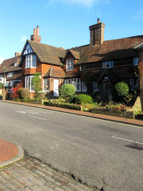
Image: © Simon Carey Taken: 20 Dec 2014
Maberleys, on the right, dates from at least the 16th century and may be earlier. Twitten House is a later extension to the left that juts out towards the High Street.
Images are licensed for reuse under creativecommons.org/licenses/by-sa/2.0
Image Location
Latitude
51.007166
Longitude
-0.14158