Junipers and Lamb Cottages, Whitemans Green, Whitemans Green
Introduction
The photograph on this page of Junipers and Lamb Cottages, Whitemans Green, Whitemans Green by Simon Carey as part of the Geograph project.
The Geograph project started in 2005 with the aim of publishing, organising and preserving representative images for every square kilometre of Great Britain, Ireland and the Isle of Man.

There are currently over 7.5m images from over 14,400 individuals and you can help contribute to the project by visiting https://www.geograph.org.uk
Junipers and Lamb Cottages, Whitemans Green, Whitemans Green
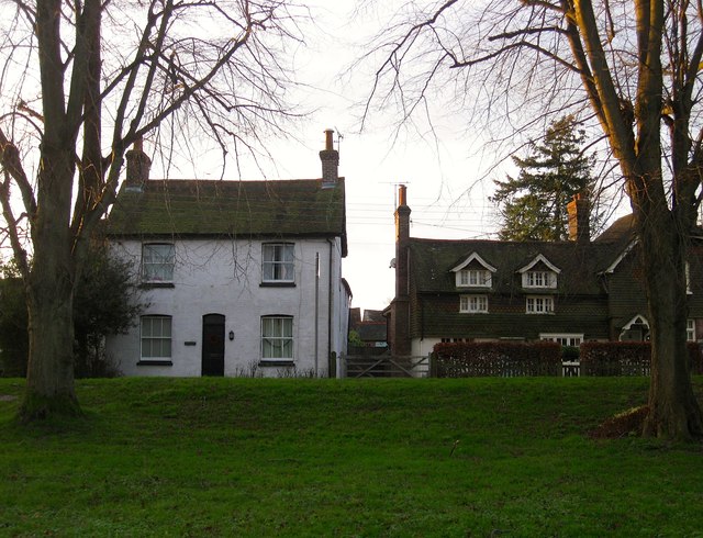
Image: © Simon Carey Taken: 20 Dec 2014
Both dwellings ace out onto the B2115 and the village green beyond it. Junipers is the white building on the left and dates to the 18th century. On the right are Lamb Cottages formerly a beer house called The Lamb. Number 1 on the left dates from the 16th century whilst number 2 was an extension added when it was a pub in the mid 19th, the same time the former was refronted in brick. Have yet to discover when it ceased trading as a beer house.
Images are licensed for reuse under creativecommons.org/licenses/by-sa/2.0
Image Location
Latitude
51.01485
Longitude
-0.144124