Village sign, Steeple Morden
Introduction
The photograph on this page of Village sign, Steeple Morden by Bikeboy as part of the Geograph project.
The Geograph project started in 2005 with the aim of publishing, organising and preserving representative images for every square kilometre of Great Britain, Ireland and the Isle of Man.

There are currently over 7.5m images from over 14,400 individuals and you can help contribute to the project by visiting https://www.geograph.org.uk
Village sign, Steeple Morden
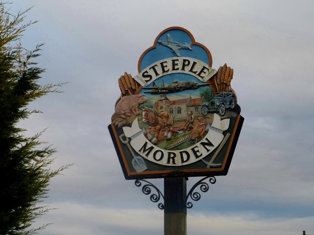
Image: © Bikeboy Taken: 7 Dec 2014
There was a WW2 airfield near to the village, home to both the RAF and USAF. The pick at the bottom right recalls the time when coprolite (a phosphate-rich mineral) was mined near to the village.
Images are licensed for reuse under creativecommons.org/licenses/by-sa/2.0
Image Location
Latitude
52.066355
Longitude
-0.122438