Seale chalk-pit, seen from Wood Lane
Introduction
The photograph on this page of Seale chalk-pit, seen from Wood Lane by Stefan Czapski as part of the Geograph project.
The Geograph project started in 2005 with the aim of publishing, organising and preserving representative images for every square kilometre of Great Britain, Ireland and the Isle of Man.

There are currently over 7.5m images from over 14,400 individuals and you can help contribute to the project by visiting https://www.geograph.org.uk
Seale chalk-pit, seen from Wood Lane
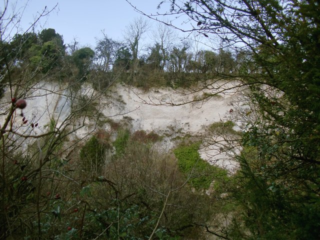
Image: © Stefan Czapski Taken: 10 Dec 2014
A disused quarry, quite high up, just below the ridge of the Hog's Back. The margins of the pit are heavily overgrown, and I found it hard to get an unobstructed view. There is no escaping the traffic noise here - the A31 runs along the ridge, just beyond the line of trees at the top of the picture. Chalk - known by the name of 'clunch' - has in the past been much used as a building material in the immediate area. Seale church (19th century) is largely clunch-built - one of a number of such buildings in the village.
Images are licensed for reuse under creativecommons.org/licenses/by-sa/2.0
Image Location
Latitude
51.226438
Longitude
-0.71179