Knightlow Cross
Introduction
The photograph on this page of Knightlow Cross by Robert Caldicott as part of the Geograph project.
The Geograph project started in 2005 with the aim of publishing, organising and preserving representative images for every square kilometre of Great Britain, Ireland and the Isle of Man.

There are currently over 7.5m images from over 14,400 individuals and you can help contribute to the project by visiting https://www.geograph.org.uk
Knightlow Cross
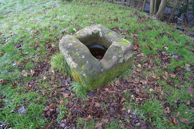
Image: © Robert Caldicott Taken: 9 Dec 2014
This is the base remnant of the ancient wayside Knightlow Cross at the top of Knightlow Hill beside the A45 (visible through the trees). The hole is the socket where the upright stem of the cross would have been placed. There is more about it here http://www.ourwarwickshire.org.uk/content/topics/traditions-and-customs/wroth-silver-ceremony-knightlow-cross
Images are licensed for reuse under creativecommons.org/licenses/by-sa/2.0
Image Location
Latitude
52.359805
Longitude
-1.406524