Knightlow Cross
Introduction
The photograph on this page of Knightlow Cross by Robert Caldicott as part of the Geograph project.
The Geograph project started in 2005 with the aim of publishing, organising and preserving representative images for every square kilometre of Great Britain, Ireland and the Isle of Man.

There are currently over 7.5m images from over 14,400 individuals and you can help contribute to the project by visiting https://www.geograph.org.uk
Knightlow Cross
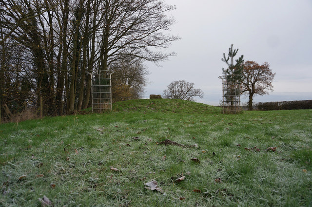
Image: © Robert Caldicott Taken: 9 Dec 2014
This shows the surviving base of the ancient Knightlow Cross on its mound. It is adjacent to the modern A45 running east/west on the other side of the tall hedge on the left, close to where the old north/south track Freeboard Lane crosses it. About 3/4 mile to the east is the roman north/south Fosse Way. More about it here http://www.ourwarwickshire.org.uk/content/topics/traditions-and-customs/wroth-silver-ceremony-knightlow-cross
Images are licensed for reuse under creativecommons.org/licenses/by-sa/2.0
Image Location
Latitude
52.359805
Longitude
-1.406524