
Ty Llosg Between Banc Du And Foel Eryr
Introduction
The photograph on this page of Ty Llosg Between Banc Du And Foel Eryr by Deborah Tilley as part of the Geograph project.
The Geograph project started in 2005 with the aim of publishing, organising and preserving representative images for every square kilometre of Great Britain, Ireland and the Isle of Man.

There are currently over 7.5m images from over 14,400 individuals and you can help contribute to the project by visiting https://www.geograph.org.uk
Ty Llosg Between Banc Du And Foel Eryr
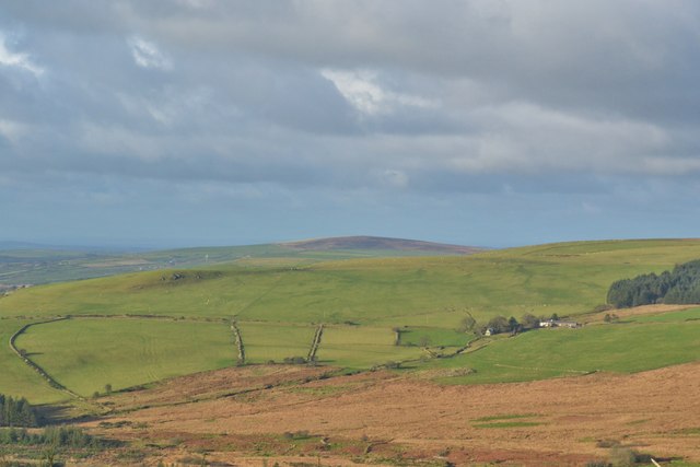
Image: © Deborah Tilley Taken: 8 Dec 2014
Situated on the road to Cardigan. The hill (centre left) in the photograph is known as Banc Du and has in the past decade been recognized as a Neolithic enclosure. A single evaluation trench was opened in August 2005. This demonstrated that the bank, about 3.8m wide, was preserved to c. 40 cm, and had been apparently set onto an old, de-turfed land surface. Postholes towards the front and rear were suggestive of a timber lacing within the bank. The ditch was 2.8m wide and a maximum of 1m deep with a U-shaped profile. Radiocarbon dates obtained through the AHRC-funded Neolithic Enclosure Dating Project show that the initial silt accumulated at around 3650 BC, whilst the middle fills contained material from the period 3000-2600 BC.
Images are licensed for reuse under creativecommons.org/licenses/by-sa/2.0
Image Location

Latitude
51.943168
Longitude
-4.815056