Bryngaer Penygaer Hillfort
Introduction
The photograph on this page of Bryngaer Penygaer Hillfort by Alan Richards as part of the Geograph project.
The Geograph project started in 2005 with the aim of publishing, organising and preserving representative images for every square kilometre of Great Britain, Ireland and the Isle of Man.

There are currently over 7.5m images from over 14,400 individuals and you can help contribute to the project by visiting https://www.geograph.org.uk
Bryngaer Penygaer Hillfort
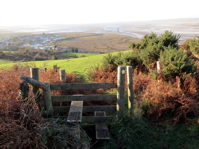
Image: © Alan Richards Taken: 8 Dec 2014
Sticil ar fryngaer Penygaer uchlaw pentre Penclawdd. Yn y pellter gellir gweld aber Llwchwr ac anheddiad o'r enw Crofty. A stile at Penygaer hillfort (trans. top of the fort) above the village of Penclawdd (trans. top of the rampart / dyke). In the distance one can see the Llwchwr estuary and the settlement known as Crofty (trans. croft's house).
Images are licensed for reuse under creativecommons.org/licenses/by-sa/2.0
Image Location
Latitude
51.638924
Longitude
-4.117151