High Bridge
Introduction
The photograph on this page of High Bridge by Simon Carey as part of the Geograph project.
The Geograph project started in 2005 with the aim of publishing, organising and preserving representative images for every square kilometre of Great Britain, Ireland and the Isle of Man.

There are currently over 7.5m images from over 14,400 individuals and you can help contribute to the project by visiting https://www.geograph.org.uk
High Bridge
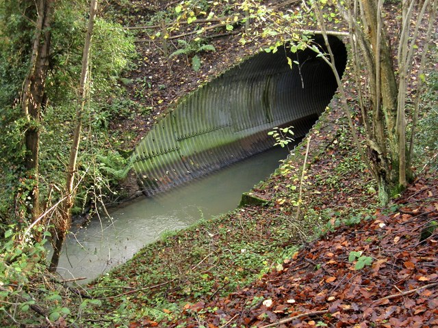
Image: © Simon Carey Taken: 29 Nov 2014
Now more of a culvert after the previous bridge collapsed in 1971. Carrying the A272 over an old mill stream which feeds into the mill pond of Highbridge Mill on the other side.
Images are licensed for reuse under creativecommons.org/licenses/by-sa/2.0
Image Location


Leaflet Map data © OpenStreetMap
Latitude
50.999817
Longitude
-0.154558