Circle Line as seen from Porchester Terrace
Introduction
The photograph on this page of Circle Line as seen from Porchester Terrace by Kevin Leach as part of the Geograph project.
The Geograph project started in 2005 with the aim of publishing, organising and preserving representative images for every square kilometre of Great Britain, Ireland and the Isle of Man.

There are currently over 7.5m images from over 14,400 individuals and you can help contribute to the project by visiting https://www.geograph.org.uk
Circle Line as seen from Porchester Terrace
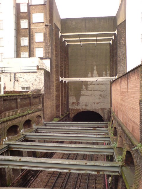
Image: © Kevin Leach Taken: 11 Dec 2006
This is where, when underground railway line was being built, houses were knocked down in order to excavate the line using the 'Cut & Cover' method. As the original trains used steam locomotives, it was necessary to leave sections of track uncovered...these sections could then be used to let out steam. So, rather than rebuild the houses that had been knocked down, they simply built false house fronts with nothing behind (viz. Nos 23/24 Leinster Gardens, Bayswater).
Images are licensed for reuse under creativecommons.org/licenses/by-sa/2.0
Image Location
Latitude
51.513402
Longitude
-0.183599