Colliton House, Glyde Path Road, Dorchester
Introduction
The photograph on this page of Colliton House, Glyde Path Road, Dorchester by Jo and Steve Turner as part of the Geograph project.
The Geograph project started in 2005 with the aim of publishing, organising and preserving representative images for every square kilometre of Great Britain, Ireland and the Isle of Man.

There are currently over 7.5m images from over 14,400 individuals and you can help contribute to the project by visiting https://www.geograph.org.uk
Colliton House, Glyde Path Road, Dorchester
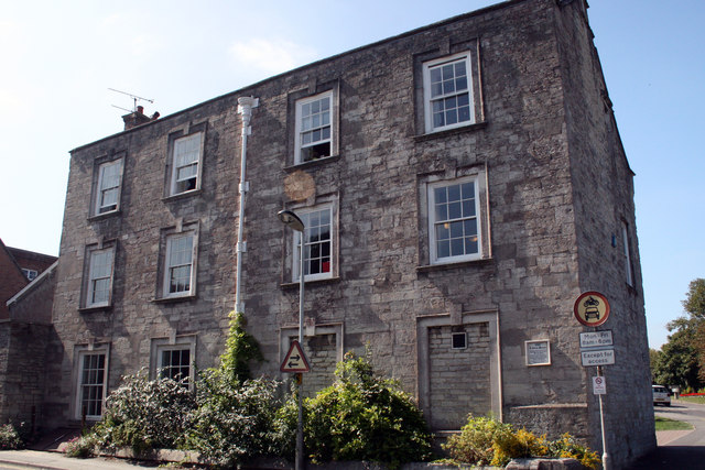
Image: © Jo and Steve Turner Taken: 6 Sep 2007
Grade II* Listed house with demolished outhouse containing a datestone of 1729 probably reflecting the later alterations. The information plaque reads 'Formerly the town house of the Churchill family. Mainly 17th century with major 18th century alterations. The site is believed to be the location of the medieval hospital of St John the Baptist fragments of which may still remain in the building and its foundations. The building has been owned by the County Council since 1933.'
Images are licensed for reuse under creativecommons.org/licenses/by-sa/2.0
Image Location
Latitude
50.716089
Longitude
-2.439615