Water Gate, Sleaford, Lincs.
Introduction
The photograph on this page of Water Gate, Sleaford, Lincs. by David Hallam-Jones as part of the Geograph project.
The Geograph project started in 2005 with the aim of publishing, organising and preserving representative images for every square kilometre of Great Britain, Ireland and the Isle of Man.

There are currently over 7.5m images from over 14,400 individuals and you can help contribute to the project by visiting https://www.geograph.org.uk
Water Gate, Sleaford, Lincs.
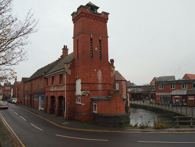
Image: © David Hallam-Jones Taken: 3 Dec 2014
Water Gate (a road name) is seen here and part of the Riverside Shopping Centre on the side of this section of the River Slea. The former fire station dominates this view. A water mill previously stood where this building now stands. The complex now houses offices but date stones on the site bear the dates of the construction of the original fire station building, i.e. 1829 and this building, 1900. The junction of Water Gate with South Gate (i.e. the B1517 road) can be seen on the left.
Images are licensed for reuse under creativecommons.org/licenses/by-sa/2.0
Image Location


Leaflet Map data © OpenStreetMap
Latitude
52.998818
Longitude
-0.411863