North Gate, Sleaford, Lincs.
Introduction
The photograph on this page of North Gate, Sleaford, Lincs. by David Hallam-Jones as part of the Geograph project.
The Geograph project started in 2005 with the aim of publishing, organising and preserving representative images for every square kilometre of Great Britain, Ireland and the Isle of Man.

There are currently over 7.5m images from over 14,400 individuals and you can help contribute to the project by visiting https://www.geograph.org.uk
North Gate, Sleaford, Lincs.
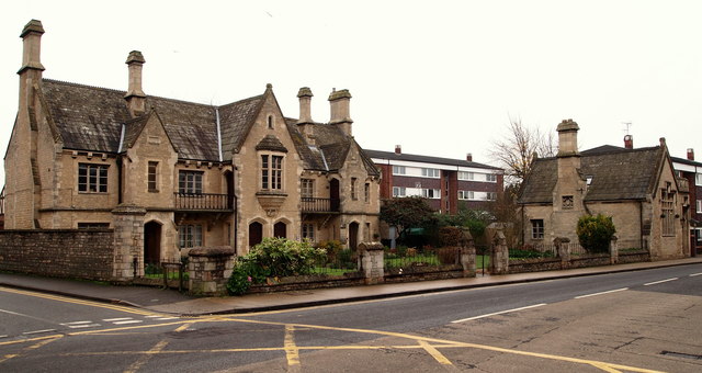
Image: © David Hallam-Jones Taken: 29 Nov 2014
Two buildings on the east side of Northgate in the Galley Hill area, with the B1518 beginning to descend towards the town centre on the right of the picture. The side road is Church Lane, which very quickly curves to form an arc round the back of these buildings and rejoins North Gate half a mile further on towards the town centre. The larger building constitutes the Northgate Almshouses built in 1857 as an addition to the Carre’s Hospital Almshouses in Eastgate. The smaller building - part of the same development - bears a stone inscription declaring it to be a "Savings Bank".
Images are licensed for reuse under creativecommons.org/licenses/by-sa/2.0
Image Location
Latitude
53.001678
Longitude
-0.410566