34 Sydenham Hill
Introduction
The photograph on this page of 34 Sydenham Hill by Stephen Richards as part of the Geograph project.
The Geograph project started in 2005 with the aim of publishing, organising and preserving representative images for every square kilometre of Great Britain, Ireland and the Isle of Man.

There are currently over 7.5m images from over 14,400 individuals and you can help contribute to the project by visiting https://www.geograph.org.uk
34 Sydenham Hill
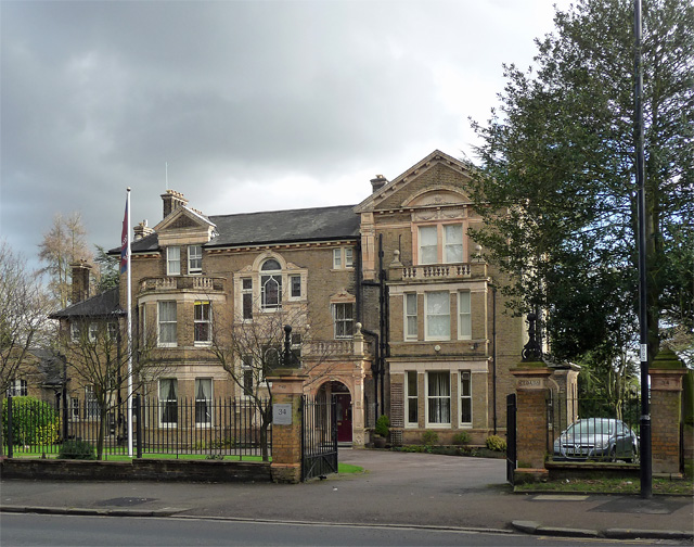
Image: © Stephen Richards Taken: 14 Feb 2013
Aka 'The Cedars'. One of the larger Victorian villas to survive on this road. Generous use of terracotta (Image]). Home to the Salvation Army International College for Officers and Centre for Spiritual Life Development.
Images are licensed for reuse under creativecommons.org/licenses/by-sa/2.0
Image Location
Latitude
51.433916
Longitude
-0.066046