New Street Vicinity, Sleaford, Lincs.
Introduction
The photograph on this page of New Street Vicinity, Sleaford, Lincs. by David Hallam-Jones as part of the Geograph project.
The Geograph project started in 2005 with the aim of publishing, organising and preserving representative images for every square kilometre of Great Britain, Ireland and the Isle of Man.

There are currently over 7.5m images from over 14,400 individuals and you can help contribute to the project by visiting https://www.geograph.org.uk
New Street Vicinity, Sleaford, Lincs.
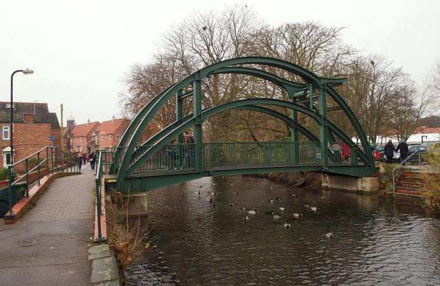
Image: © David Hallam-Jones Taken: 29 Nov 2014
Boat users wishing to travel through Sleaford are able to benefit from this new £150,000 bridge that was installed in 2008. It replaced the former fixed footbridge that stopped most traffic – apart from canoes – from proceeding any further. The lift-up section is operated manually by the user when needed. The footpath element of the bridge is also wider, allowing wheelchair users, and people pushing prams, to cross more easily. A new river access point has also been created with the construction of the new slipway near The National Centre for Craft and Design building up ahead. Carre Street and the town centre lie ahead and New Street is reached via a ramp or steps on the left.
Images are licensed for reuse under creativecommons.org/licenses/by-sa/2.0
Image Location
Latitude
52.998399
Longitude
-0.407408