Carre Street, Sleaford, Lincs.
Introduction
The photograph on this page of Carre Street, Sleaford, Lincs. by David Hallam-Jones as part of the Geograph project.
The Geograph project started in 2005 with the aim of publishing, organising and preserving representative images for every square kilometre of Great Britain, Ireland and the Isle of Man.

There are currently over 7.5m images from over 14,400 individuals and you can help contribute to the project by visiting https://www.geograph.org.uk
Carre Street, Sleaford, Lincs.
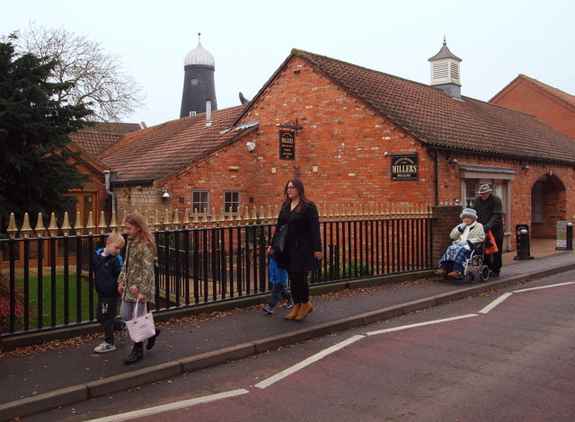
Image: © David Hallam-Jones Taken: 29 Nov 2014
This road bridge carries Carre Street over the dry, non-navigable spur of the Sleaford Navigation (a canal) that ends here abruptly where this restaurant has created an outdoor dining area. Behind the photographer blue 'finger signs' at the entrance and/or exit of a footpath point pedestrians in the direction of various local leisure-related amenities. The same footpath also leads to Cogglesford Mill Lock. Money's Mill, a former windmill situated in Money's Yard Car Park, is also visible. It was built c.1796 to capitalise upon the existence of the new canal that allowed for corn to be off-loaded from barges at the foot of it.
Images are licensed for reuse under creativecommons.org/licenses/by-sa/2.0
Image Location
Latitude
52.997776
Longitude
-0.407878