Buildings on London Road, Marlborough
Introduction
The photograph on this page of Buildings on London Road, Marlborough by Derek Harper as part of the Geograph project.
The Geograph project started in 2005 with the aim of publishing, organising and preserving representative images for every square kilometre of Great Britain, Ireland and the Isle of Man.

There are currently over 7.5m images from over 14,400 individuals and you can help contribute to the project by visiting https://www.geograph.org.uk
Buildings on London Road, Marlborough
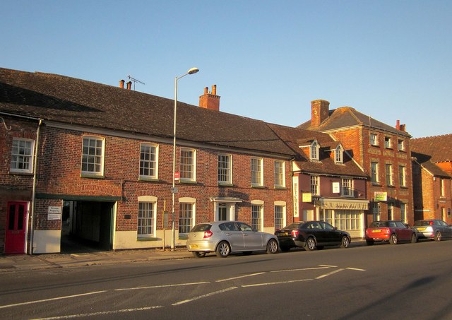
Image: © Derek Harper Taken: 21 Jun 2014
The buildings are listed. On the extreme right, with hipped roof, is No 12 https://historicengland.org.uk/listing/the-list/list-entry/1034207 ; next door, with the dormers is No 11 https://historicengland.org.uk/listing/the-list/list-entry/1034206 ; No 10, with the Tuscan pilasters either side of the door, is listed as C13, but surely they mean C18? http://list.english-heritage.org.uk /resultsingle.aspx?uid=1258767&searchtype=mapsearch .
Images are licensed for reuse under creativecommons.org/licenses/by-sa/2.0
Image Location


Leaflet Map data © OpenStreetMap
Latitude
51.420684
Longitude
-1.72642