Pearson Bridge north-east of Buglawton, Cheshire
Introduction
The photograph on this page of Pearson Bridge north-east of Buglawton, Cheshire by Roger D Kidd as part of the Geograph project.
The Geograph project started in 2005 with the aim of publishing, organising and preserving representative images for every square kilometre of Great Britain, Ireland and the Isle of Man.

There are currently over 7.5m images from over 14,400 individuals and you can help contribute to the project by visiting https://www.geograph.org.uk
Pearson Bridge north-east of Buglawton, Cheshire
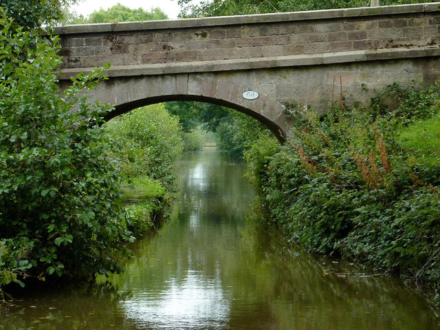
Image: © Roger D Kidd Taken: 4 Sep 2014
This section of the canal is heavily overshadowed by mature trees. Pasture is on both sides. Pearson Bridge, No 64, is an accommodation bridge linking the pastures and carries no public right of way. There has been comment in the boating fraternity this year (2014) that the recently formed Canal and River Trust is not clearing vegetation growth from canal sides as efficiently as did the former British Waterways, especially by bridges. The Macclesfield Canal in particular has been mentioned.
Images are licensed for reuse under creativecommons.org/licenses/by-sa/2.0
Image Location
Latitude
53.181514
Longitude
-2.179369