Monk's Mill, Scrooby
Introduction
The photograph on this page of Monk's Mill, Scrooby by Alan Murray-Rust as part of the Geograph project.
The Geograph project started in 2005 with the aim of publishing, organising and preserving representative images for every square kilometre of Great Britain, Ireland and the Isle of Man.

There are currently over 7.5m images from over 14,400 individuals and you can help contribute to the project by visiting https://www.geograph.org.uk
Monk's Mill, Scrooby
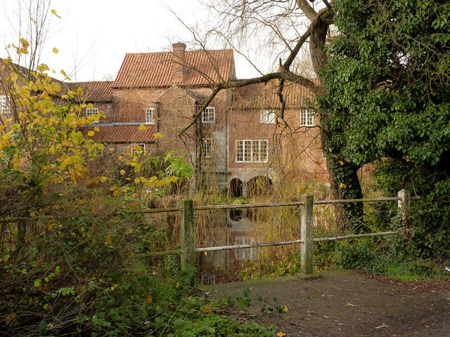
Image: © Alan Murray-Rust Taken: 24 Nov 2014
This is the rear of the mill, seen across the former tailrace. The mill buildings are an amalgam of sections, dating back in part to the 17th century. The mill appears to have had three wheels at one stage, making use of the flow of the River Ryton, but there is now only a trickle through the pond. Listed Grade II.
Images are licensed for reuse under creativecommons.org/licenses/by-sa/2.0
Image Location
Latitude
53.411891
Longitude
-1.02179