No 791 Upper Newtownards Road, Dundonald (November 2014)
Introduction
The photograph on this page of No 791 Upper Newtownards Road, Dundonald (November 2014) by Albert Bridge as part of the Geograph project.
The Geograph project started in 2005 with the aim of publishing, organising and preserving representative images for every square kilometre of Great Britain, Ireland and the Isle of Man.

There are currently over 7.5m images from over 14,400 individuals and you can help contribute to the project by visiting https://www.geograph.org.uk
No 791 Upper Newtownards Road, Dundonald (November 2014)
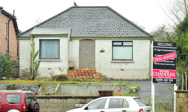
Image: © Albert Bridge Taken: 26 Nov 2014
A vacant bungalow, at the corner of the Upper Newtownards Road and Galway Park, now with a “deal agreed” sign. There is the following planning permission (7 June 2011) “Y/2010/0310/F Replacement of existing detached dwelling with two semi-detached houses with one integral garage and driveway to the front of the properties and one stand alone garage to rear of properties”. This photograph appears as a matter of geographical and historical record only. I have no connection with any of the parties involved in the sale or proposed redevelopment.
Images are licensed for reuse under creativecommons.org/licenses/by-sa/2.0
Image Location
Latitude
54.594348
Longitude
-5.817111