Covered reservoir
Introduction
The photograph on this page of Covered reservoir by Neil Owen as part of the Geograph project.
The Geograph project started in 2005 with the aim of publishing, organising and preserving representative images for every square kilometre of Great Britain, Ireland and the Isle of Man.

There are currently over 7.5m images from over 14,400 individuals and you can help contribute to the project by visiting https://www.geograph.org.uk
Covered reservoir
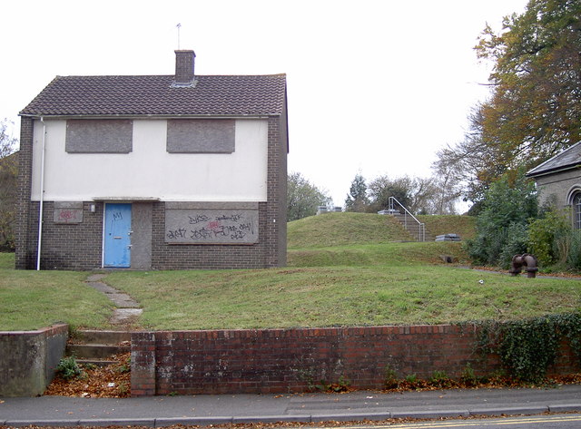
Image: © Neil Owen Taken: 27 Oct 2014
The higher ground on the Devizes Road makes for an ideal location for the installation of a reservoir. The site dates from the latter part of the 1800s but the boarded 'house' is clearly post-war. See Image] for the building to the right of shot.
Images are licensed for reuse under creativecommons.org/licenses/by-sa/2.0
Image Location
Latitude
51.076732
Longitude
-1.811243