St Edith, Anwick
Introduction
The photograph on this page of St Edith, Anwick by Dave Hitchborne as part of the Geograph project.
The Geograph project started in 2005 with the aim of publishing, organising and preserving representative images for every square kilometre of Great Britain, Ireland and the Isle of Man.

There are currently over 7.5m images from over 14,400 individuals and you can help contribute to the project by visiting https://www.geograph.org.uk
St Edith, Anwick
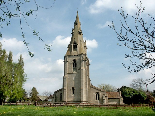
Image: © Dave Hitchborne Taken: 24 Apr 2004
The church stands about 4½ miles north-east of Sleaford, just off the A153. A statue of the Virgin was discovered walled up in the church in 1859.
Images are licensed for reuse under creativecommons.org/licenses/by-sa/2.0
Image Location
Latitude
53.04178
Longitude
-0.338686