Braxted Park Stile
Introduction
The photograph on this page of Braxted Park Stile by Glyn Baker as part of the Geograph project.
The Geograph project started in 2005 with the aim of publishing, organising and preserving representative images for every square kilometre of Great Britain, Ireland and the Isle of Man.

There are currently over 7.5m images from over 14,400 individuals and you can help contribute to the project by visiting https://www.geograph.org.uk
Braxted Park Stile
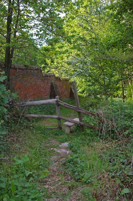
Image: © Glyn Baker Taken: 6 May 2007
This stile is on the footpath that skirts the boundary wall of Braxted Park House. The wall in the picture is around 5km long and surrounds the estate, I assume was built from about 1828 to 1835 according to the various markers inset into the wall, you can see one at Image For a peep over the wall just beyond the stile, see Image & Image
Images are licensed for reuse under creativecommons.org/licenses/by-sa/2.0
Image Location


Leaflet Map data © OpenStreetMap
Latitude
51.804649
Longitude
0.705392