Holywell Street, Chesterfield, Derbys.
Introduction
The photograph on this page of Holywell Street, Chesterfield, Derbys. by David Hallam-Jones as part of the Geograph project.
The Geograph project started in 2005 with the aim of publishing, organising and preserving representative images for every square kilometre of Great Britain, Ireland and the Isle of Man.

There are currently over 7.5m images from over 14,400 individuals and you can help contribute to the project by visiting https://www.geograph.org.uk
Holywell Street, Chesterfield, Derbys.
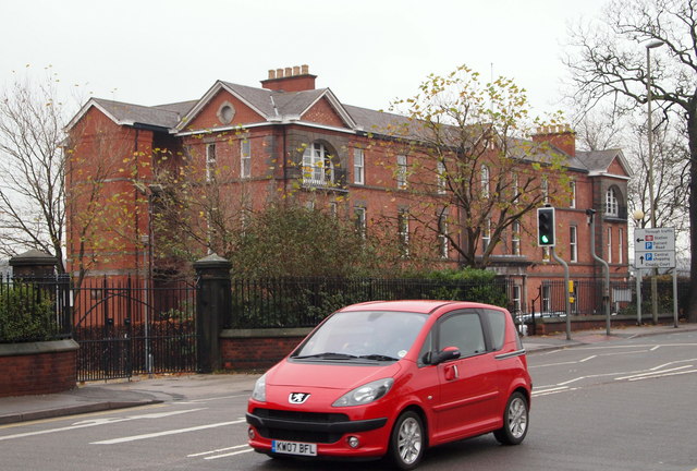
Image: © David Hallam-Jones Taken: 22 Nov 2014
The former Royal Hospital (1859-1984/6), that now houses offices, faces the large Holywell Cross car park encompassed by various roads (hence it is sometimes referred to as "The Doughnut Roundabout"). The new Chesterfield & North Derbyshire Royal Hospital in Calow opened in April 1984. In 1986 building work began on a maternity and gynaecology unit on the Calow site and its opening in 1989 led to the final facilities in the town centre being closed. In 1984, the hospital was purchased by an orthopaedic surgeon who converted the lower portion of the hospital, adjoining Infirmary Road and Durrant Road, into the Alexandra Private Hospital. This seems to have functioned until the early 1990s.
Images are licensed for reuse under creativecommons.org/licenses/by-sa/2.0
Image Location
Latitude
53.238519
Longitude
-1.426555