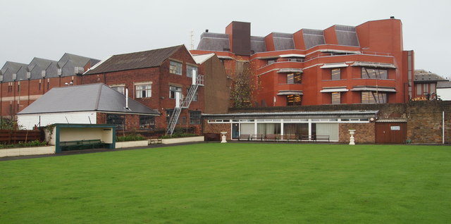
Beetwell Street, Chesterfield, Derbys
Introduction
The photograph on this page of Beetwell Street, Chesterfield, Derbys by David Hallam-Jones as part of the Geograph project.
The Geograph project started in 2005 with the aim of publishing, organising and preserving representative images for every square kilometre of Great Britain, Ireland and the Isle of Man.
There are currently over 7.5m images from over 14,400 individuals and you can help contribute to the project by visiting https://www.geograph.org.uk

Image: © David Hallam-Jones Taken: 22 Nov 2014
An 'over-the-garden-wall' shot of the home of Chesterfield Bowling Club taken from its south end. Neither the building with the side fire escape or the lower building with the grey roof are part of the club's premises and neither are the ultra modern buildings behind it. The entrance to the club are via a set of stone steps leading down from Beetwell Street. These are not visible here but are located on the right hand side of the white post visible on the right hand margin of this photo. The bowling green is said to date from the C13th/C14th.

