
Drilling winter wheat near Bourne
Introduction
The photograph on this page of Drilling winter wheat near Bourne by Rex Needle as part of the Geograph project.
The Geograph project started in 2005 with the aim of publishing, organising and preserving representative images for every square kilometre of Great Britain, Ireland and the Isle of Man.

There are currently over 7.5m images from over 14,400 individuals and you can help contribute to the project by visiting https://www.geograph.org.uk
Drilling winter wheat near Bourne
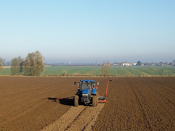
Image: © Rex Needle Taken: 13 Nov 2005
Farming in the countryside is an unending cycle of activity to maintain the continuous production of our food, from spring through to winter, and no sooner has one crop been harvested than another is planted. This field to the north of Bourne which is outside my study window is the perfect place from which to observe the farming year with the misty outline of Morton church tower and the white-washed cottages of Dyke village on the horizon. A few weeks before this picture was taken the field was full of golden corn which was soon harvested, the land ploughed and harrowed and now, on a morning of bright but hazy sunshine, it is the turn of the drill to sow winter wheat which will soon become established to withstand the cold weather to come and so ensure a strong and healthy yield next summer.
Images are licensed for reuse under creativecommons.org/licenses/by-sa/2.0
Image Location

Latitude
52.780251
Longitude
-0.371052